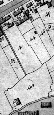
Fig. 1. Excerpt from 1842 Tithe Map (left) showing the location of 21 the Causeway (plot 43) and Cooks Close (plot 40), with thanks to Dr Christopher Currie.
Pound House
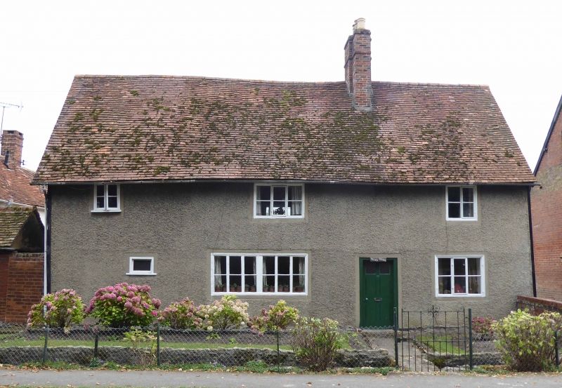
'Pound House' in 2024, before the current restoration. Note the rendered finish and modern windows.
According to painstaking archive research by Dr Christopher Currie and Nat Alcock, Pound House – 21 The Causeway – is on a plot that was recorded as being granted by the Lord of the Manor to the White family in 1557. At that point there were three house sites lying between the brook and ‘Twychyns’, which was a plot of land on the banks of the Ginge brook, which had all previously been owned by Henry Cook and became known as ‘Cook’s Close’, and another house with land that had previously been owned by a William Chapman – all of which had been bought and bundled together by a John Pulker of Sutton Courtney in the late 15th century. It’s thought that the current Pound House was probably built by the White family on the old Chapman site in the second half of the 16th century.
Pound House is now being restored. The original timber frame and much of its wattle and daub is in good condition – particularly on the sheltered north and east faces – and samples have been taken for dendrochronological dating. The old roof timbers in the centre are blackened, showing that the original house did not have a chimney, and that the smoke straight up an open ‘smoke bay’ to the roof.
A Tithe Map of 1842 intriguingly shows the plot which now contains Pound House and its remaining outbuilding also containing a large second building, seemingly contiguous with the outbuilding, in what is now the garden, although this map seems inaccurate when compared with the almost contemporary 1841 Ordnance Survey map.
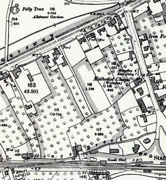
Excerpt from an 1841 Ordnance Survey map of the same area (right) – showing Cooks Close as plot 117 and a possibly more accurate representation of the buildings that comprise Pound House (with the word ‘Post’ of ‘Post Office’ over its plot) alongside the brick terrace of 23-29 The Causeway to its west.
In September 2025, volunteers from South Oxfordshire Archaeology Group undertook a geophysical of the garden to look for any evidence of previous structures, with a view to undertaking some test digs in the autumn.
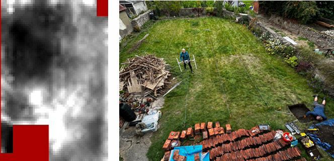
The existing Pound House is at the bottom of the image. The red area at the top is a patio, in front of the existing outbuilding. White indicates areas of high resistance - probable rubble. Dark indicates low resistance – probable soft soil. Right, photo from Pound House showing the garden area surveyed. John is standing where the white, high resistance area is revealed.
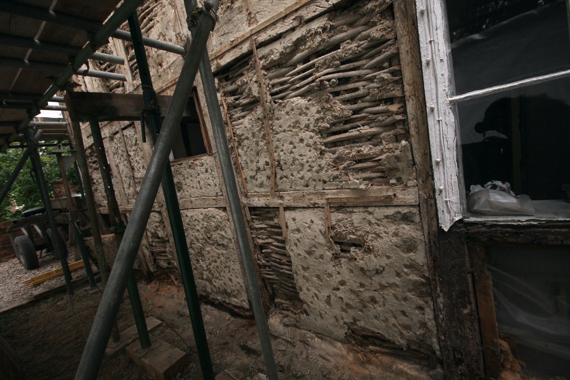
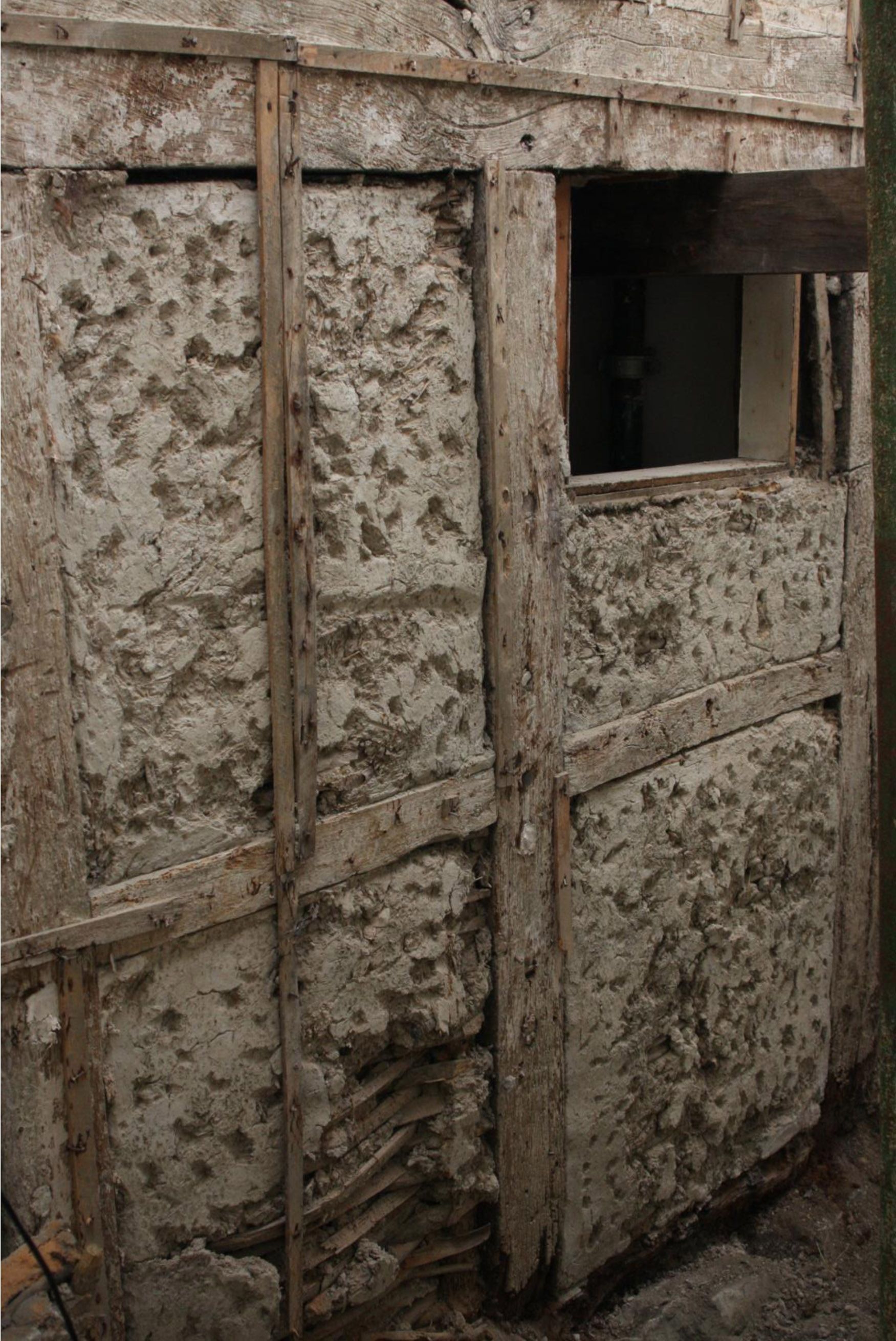
External wall (front elevation) after removal of render
Behind the render covering is the original wattle and daub. Considering its age and the treatment that its had the condition of the original frame is remarkably good. The scaffolding is needed to support the frame during restoration and replacement of some of the timber which has rotted away. This is decay most obvious where the frame touches the ground.


View more
Links:
British Listed Buildings Pound House, Steventon, Oxfordshire
Historic England Pound House, Steventon - 1368077 | Historic England
